

New Aerial Technologies Target Early Wildfire Suppression
Advancements in autonomous drone swarms and specialized satellite constellations are providing fire agencies with new tools to detect and suppress wildfires before they escalate. These technologies aim to bridge the gap between initial ignition and large-scale emergency response.
As wildfire seasons across North America and beyond become increasingly prolonged, fire management agencies are integrating new autonomous technologies designed to detect and suppress blazes in their infancy. Recent developments in both orbital surveillance and aerial intervention represent a shift toward rapid-response strategies intended to contain fires before they grow into uncontrollable events.
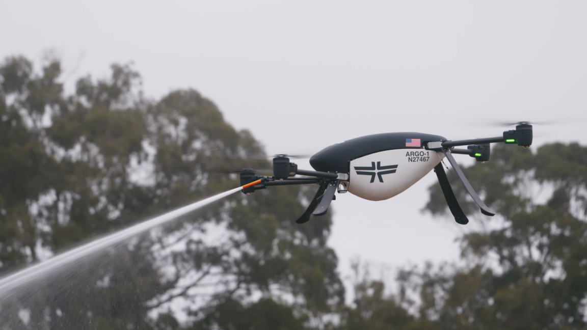
On the ground, autonomous drone swarms are being tested as a tactical tool for immediate suppression. During a July 15 demonstration, the California Department of Forestry and Fire Protection (CAL FIRE) utilized five drones to deploy between 500 and 1,000 gallons of fire-suppressing foam, according to KPMH. These systems, such as the Argo-1 drones developed by Seneca, are designed to operate in coordinated groups. While they lack the payload capacity of traditional crewed airtankers, their mobility allows them to be transported by ground vehicle and deployed quickly to remote locations. The current operational model focuses on rapid turnaround, with companies aiming for two-minute intervals to swap batteries and refill payloads.
Complementing these tactical efforts is the deployment of the FireSat satellite constellation, which reached initial operational capability following a July 7 launch from Vandenberg Space Force Base. Managed by the nonprofit Earth Fire Alliance and supported by over $15 million in funding from Google and $26 million from the Bezos Earth Fund, the program is the first satellite network purpose-built for wildfire detection, as reported by Ars Technica.

Unlike general-purpose satellites, FireSat microsatellites utilize multispectral imaging to peer through smoke and cloud cover, identifying fires as small as five by five meters. This granular data is intended to provide fire agencies with actionable intelligence hours before traditional detection methods might identify a blaze. Google Research is further integrating AI models to analyze this data against historical imagery, aiming to improve predictive modeling and fire identification accuracy.
While these technologies offer significant potential for damage mitigation, their effectiveness remains tied to logistical integration. Drones require prepositioning or rapid transport to fire-prone areas, and the full FireSat constellation is not expected to reach its target revisit rate of 20 minutes until the early 2030s. If these systems successfully scale, the Earth Fire Alliance projects they could prevent millions of tons of carbon emissions and protect millions of acres of land, marking a transition toward a more proactive, technology-driven approach to wildfire management.